Loading Map

Saturday, March 29, 2014

A man, a plan, a canal, Panama

Panama City, Panama

We finally made it to Panama City, no thanks to Punta Mala.  This passage was every bit as nasty as we were warned, and it appears that we did pick one of the best days to do it - many other cruisers had it much worse.

 We left Ensenada Benao around 7AM and motored towards Punta Mala in very light winds, with very little current for the first couple of hours.  As we got close to the point, the current got stronger and the wind picked up as well.  We had specifically chosen our arrival for the flood tide, in order to counteract some of the prevailing current, but it was still a battle.  It did not help that I am still babying our drive train and unwilling to put too much RPM on the engine, in hopes that the stuffing box will hold together for a bit longer.  In any case, we did manage to claw our way around the point in about 3 or 4 hours.

Once we were clear of the cape, we still had to contend with almost constant head winds, between 10 and 20 knots most of the time, and counter current, all the way to Panama City.  We tried sailing a bit, but could not point at all towards our destination, so we motor-sailed the entire distance with only our double-reefed main up, sometimes having to tack back and forth to make any progress against the wind and waves.  At times we were moving at over 4 knots, but a lot of the time we were reduced to less than 2 knots.  All in all, it took us 32 hours for the 110 mile passage, burning a heck of a lot of diesel to do it.  Fortunately, the wind calmed down for the last few hours, while crossing the canal traffic and finding the anchorage at La Playita.

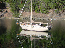
Saint Richard - kind of says it all, doesn't it?
As a sailing destination, I am not too impressed with Panama City.  There is no real alternative to anchoring out, as the few marinas here are very expensive and totally taken up by permanently moored power boats - they are not at all interested in transient cruisers.  There is one yacht club (Balboa) that has some transient moorings (no docks), but they are totally full as well.

There are two main anchorages, each with its own issues.  On the north side of the causeway is the Las Brisas anchorage, with a beautiful view of the city across the bay.  This anchorage has virtually no protection from the north winds that blow continuously this time of year, and the dinghy landing is so treacherous that we were advised to expect to break bones or need stitches if we tried it (possibly an exaggeration?).

The more popular choice, at this time of year, is the anchorage at La Playita, on the south side of the causeway, where we currently are.  This anchorage is quite crowded and, while seemingly sheltered from the north, the winds still manage to funnel in and toss us about.  Unless you are one of the lucky boats that manages to grab a spot close to the land, you still get a fair amount of wind-waves.  The icing on the cake is the wakes from the passing ships on their way to and from the canal - they are quite nasty at times and have prevented us from being able to keep our dinghy on our pitiful davits - I tried once and when we got hit by a big wake, the back end of our boat actually pushed our dinghy under water, nearly breaking it in two - so now we just tie it on beside the boat and hope for the best.

The one advantage this anchorage has is access to a dinghy dock, for a nominal fee, at the La Playita yacht club.  Unfortunately it appears that some cruisers, possibly not knowing any better, have been using the dock without paying and the management has decided to take drastic action and close the dock to all cruisers, starting on Monday (the day after tomorrow).  No one is really sure what we are going to do then as there is no place else to land a dinghy on this side of the causeway - the whole shore is a rocky breakwater subject to 12 foot tides.  Come Monday we may not be able to leave the boat at all, which is going to make it very difficult to get any work done.

So far, the only sight-seeing we have done has been to travel to the various offices to get our Panama visas and the cruising permit for the boat.  We did get to the Albrook mall, where I got a much-needed haircut and we broke down and bought a "smart" phone and some time on a local phone carrier so now we have Internet service on the boat.  Up till now we have had no access to WiFi or anything here - thus the delay in getting this post out.

Today, I started tackling the stuffing box issue, but I think I need to talk to a mechanic for second opinion before I proceed.  We are not sure just how long we will have to wait to get the boat hauled once we have the needed parts - the haul-out yard is very small and very busy (and very expensive).

I guess I sound a little discouraged, but I am sure everything will look better in the morning.  On the plus side, we have met up with several boats that we had befriended over the last few years - this really is a place that everyone seems to visit at some point.  On Thursday nights, they have a "pizza' night at one of the local restaurants.  Lots of cruisers and really good pizza!
 
{GMST}08|54.322|N|79|31.392|W|Panama City, Panama|Panama City, Panama{GEND}


Monday, March 24, 2014

Benao blues

Ensenada Benao, Panama

The waiting game...

Here we sit in the anchorage at Ensenada Benao, patiently waiting for a good weather window for rounding Punta Mala and making our way to Panama City. Punta Mala is only about 12 miles from where we sit and we seem to get the brunt of the same winds that hound that point, making this, at times, a very uncomfortable place to be. The winds, often gusting between 20 and 30 knots, in combination with the prospect of a "surf" landing, have prevented us from launching our dinghy off the deck, so we have been confined to the boat for the last three days - not much to do except read and play games. It will be so nice when we can finally get out of here.


While we have been here, a few other boats have come and gone, obviously much better able to handle the wind and waves around the cape, or at least not as chicken as we are (to be honest, they are mostly much larger boats than us). We are just tired of beating into headwinds everywhere we go. For the last 3 nights, we have shared the anchorage with two other Canadian sailboats, one of which left this morning. Our feeling is that tomorrow (Tuesday) morning looks like the best opportunity we will have for an easy sail around Punta Mala, with relatively light winds and a favorable tide, so we plan to be up and out of here early tomorrow.

Once around the cape, it is another 100 miles to Panama City with no real good alternative places to stop along the way - with any luck we will be there sometime on Wednesday morning. Note: Rain is in the forecast for the next couple of days in the Gulf of Panama, so it could be a wet ride.

{GMST}07|25.533|N|80|11.411|W|Ensenada Benao, Panama|Ensenada Benao, Panama{GEND}

Friday, March 21, 2014

In for a blow!

Ensenada Benao, Panama

After two blissfully tranquil nights in Bahia Honda, it was time to move on. We knew the next couple of passages were bound to be more challenging, but the strong winds still took us a bit by surprise.

For the first half of the journey, the winds were light and we even managed to sail for a few hours - everything was looking pretty good. As night fell and we started rounding the point at Punta Mariato, we picked up some favorable current along with light headwinds - we were motoring along very nicely. Sometime around 3AM, the winds, from right on the nose of course, picked up to 12 to 18 knots. We attempted to sail for a while but with the bad angle we could make, we made little forward progress, and ended up motorsailing the rest of the night.

As dawn broke, we found ourselves beating into the tidal rips off of Morro de Puercos, probably staying a bit too far off shore. The boat had lots of fun climbing and diving into the steep waves. Our favorable current seemed to have left us as well and we made very slow progress for several hours.

As we approached our destination at Ensenada Benao, the winds just kept getting stronger, and constantly from directly in front of us. We motored with just our double-reefed mainsail up, tacking back and forth into 18 to 25 knots of wind and nasty wind-waves - very slow, bumpy ride.

Entering the bay at Ensenada Benao, around noon, the winds did not abate, although the sea was much smoother. We set our anchor outside of a couple of other boats that were already here, and watched the winds climb into the low 30s in the afternoon. We kept a careful watch on our anchor but it seemed to be well set. A couple on one of the other boats, Neil and Peggy on Night Sky (another Canadian boat) gave us a ride to shore in their dinghy, where we were able to stretch our legs and get some food and drink at one of the surf hangouts which abound here - apparently this is a sort of surfer's paradise.

As far as the boat and equipment goes, everything is holding together quite well, except for our primary netbook computer, which has totally failed, taking with it some irreplaceable data. I have managed to get our backup netbook up and running and briefly connected to the internet via our big Wifi antenna - thus making this blog entry possible, although not enough of a connection for photos.

The other two boats left this morning to challenge Punta Mala on their way to Panama City. We have elected to wait another day in hopes of a more favorable forecast around the point. Checking the "spot" forecasts and grib files this morning are making us think it unlikely it will get any better for the next week. Most likely we will venture around the point tomorrow.

{GMST}07|25.533|N|80|11.411|W|Ensenada Benao, Panama|Ensenada Benao, Panama{GEND}

Monday, March 17, 2014

Honda

Bahia Honda, Panama

We spent two nights at Isla Parida. We had the whole bay to ourselves for the day, so we moved to what appeared to be the quietest spot (out of the swell) and I did a rudimentary cleaning of the hull, at least what I could reach snorkeling around the boat. I also made another attempt at getting an engine temperature gauge working. I had already replaced the electronic temp sensor back in Playas del Coco, which did not help - so now I replaced the electronic gauge itself with one that I had purchased in Coco. The new gauge worked worse than the old one, so I ended up going back to the original. I did manage to replace the failed mechanical gauge with another cheap unit that I had bought back in Nicaragua and it does appear to be working OK. Progress of a sort.

Today we made a quick passage to a bay called Bahia Honda. There was very little wind all day and we had 56 miles to cover, so we ended up motoring the entire way. At least this was an all-daylight passage for a change. We arrived at Bahia Honda around 4PM and as soon as we had the anchor down, we were met by a friendly family who lives on the shore. We traded some treats and batteries for some bananas and lemons.


This is a gorgeous and very tranquil place - we should sleep well tonight. We are hoping to pick up some weather information about rounding the cape at Punta Mala, which will dictate how long we stay here before moving on to an anchorage closer to the cape. Punta Mala is the last hurdle to jump before heading for Panama City and it has a nasty reputation for making sailors humble.

{GMST}07|45.938|N|81|32.347|W|Bahia Honda, Panama|Bahia Honda, Panama{GEND}

Saturday, March 15, 2014

Panama bound

Isla Parida, Panama

We checked out of Costa Rica on Thursday as planned. Much easier than the check in process we endured back in Golfito - lots of walking but we were through by noon.

In the afternoon, I spent some time ferrying jerry cans of diesel fuel from the Banana Bay marina out to Sine Timore via the dinghy. With the generous help of Bill from the sailing vessel Fai Yin, and the loan of his two jerry cans, we only had to make three trips to fill the tank. Price was actually a little better than we had been expecting, working out to about $1.38 Cdn per liter. Meanwhile, Susanne did a little bit of provisioning for some fresh produce at the local stores. We were done and just got back to the boat in time for a thorough dowsing of rain. This is the 2nd night we have had rain here in the late afternoon, which is apparently the normal pattern for this area. The boat deck looks cleaner than it has in months.

We did not actually leave the anchorage until Friday morning, around 10:30AM. We motored out of the estuary against a modest flood tide in hopes of catching the early afternoon winds out in the Golfo Dulce. Indeed, we were able to sail, close hauled of course, for 5-1/2 hours, covering almost 20 miles of our total 94 mile passage - this we consider a good day of sailing for us.

We crossed over into Panamanian waters sometime in the evening, with a full moon lighting our way. We could see some distant storm cells behind us, and we did observe a bit of lightning overhead, but we did not actually get rained on at all.

We pulled into our current anchorage on the south side of Isla Parida around 9:30AM. It seemed like a nice well-protected spot but it has been a bit rolly with a swell that is coming in from the south. Right now we are sharing the bay with two other boats, neither of which we have seen before. We are not sure just now whether we are going to hang out here another day or press on further south (east?) tomorrow. It is a very pretty spot - sort of like what you imagine Treasure island would look like - very tropical. Oh, and hot and humid of course.


On the boat front, my new mechanical engine temperature gauge is no longer working - no idea why! Maybe this engine is just not destined to have a working gauge.

{GMST}08|05.616|N|82|20.251|W|Isla Parida, Panama|Isla Parida, Panama{GEND}

Wednesday, March 12, 2014

Golfito

Golfito, Costa Rica

Two days ago, Monday, we left the anchorage at Bahia Drake, bound for Golfito.  Basically this consists of circumnavigating the Osa peninsula, entering the Golfo Dulce, then ducking through a narrow entrance channel into the Golfito estuary.

Since we had lots of time (it is only a 70 mile journey), we elected to leave in the early afternoon with the hope that we would be able sail some or all of the way.  We did sail for the first 4 hours, trying to beat into a light headwind to get around the top of the peninsula.  After a very frustrating 4 hours, making no more than 6 miles towards our destination, the wind totally died and we motored for all but about 2 hours of the rest of the passage.  The only consolation was another spectacular sunset - over Isla del Cano.

We watched some huge storm cells on the radar screen all around us throughout the night but never got a drop of rain.

We were on the final approach to Golfito by 9:30AM.  There is every shade of green you can imagine around here - very lush - definitely rain forest.  Just inside the entrance to the estuary we found one of the yacht delivery ships - these are very cool boats that transport sailing and power yachts throughout the world - this is one of their main stops on the west coast of America.  It is nice to know we have alternatives if we get tired of sailing the boat everywhere.

Can you pick out the port-side channel buoy?  Hint: It's green.

 
We found a nice spot to anchor and took the dinghy to shore.  There is a very cruiser-friendly business here that provides a dinghy dock, WIFI Internet, a clubhouse with a shower and an honor system for cold drinks, all for a nominal fee.  We have met up with several other cruisers that we have seen along the way from El Salvador.  This place is sort of the hub for cruising boats in southern Costa Rica.  There are a couple of nice restaurants within walking distance and the town is not all that far away either.  The only real problem for us is the humidity.  A lot of the boats here have been telling us about the incredible amount of rain they get here every afternoon or night, so we have battened down our hatches and tried to rig everything for some heavy weather.  Of course, since we have been here, there has not been a drop of rain.

BTW: Of the 11 cruising sailboats in the anchorage and the marina next door, 7 are Canadian.

Tomorrow we intend to check out of the country, with the intent to leave the day after, which is a Friday.  We wouldn't mind staying here for another day or two but the problem is that this Friday is payday and we have been warned that it will take forever to pay our port fees at the bank on that day, and the official offices are not open on Saturday, Sunday or Monday - thus if we don't check out tomorrow, Thursday, we will not be able to do so until next Tuesday, and we really did not want to linger here that long.

{GMST}08|37.181|N|83|09.176|W|Golfito, Costa Rica|Golfito, Costa Rica{GEND}


Monday, March 10, 2014

Lagoon

Bahia Drake, Costa Rica

The anchorage was not too rough last night - this place has potential.  If we did not have so far to go before the end of the month, we would be tempted to linger here longer.

Tropical paradise?


Today we did manage to launch the dinghy and do a small bit of exploring.  Near the south entrance to the bay, right where the surf starts to break, lies the entrance to a small lagoon, home to a few local pangas and a couple of eco-tourist type hotels.  At high tide, we braved the lagoon entrance, following a couple of more experienced cruisers in their dinghy.  We motored very slowly up the river for a km or so, then floated back out on the outgoing tide.  Very tranquil surroundings, listening to the birds and watching the butterflies and the odd kayakers.


Back at the entrance, we tied the dinghy up to the dock at the resort and did a short hike towards the beach.  We did not go far, in spite of the fact that the foliage was spectacular - it is just too hot and humid for us as we are not acclimatized to this country as yet.  NOTE: Still no rain.


Back on the boat, we re-stowed the dinghy on deck, preparatory for leaving late this afternoon for yet again another overnight passage.  Our anticipated destination is Golfito, which should be our last stop in Costa Rica, and where we have to check out of the country.


On the boat front, I have an area of concern.  Our PSS dripless prop shaft seal looks like it is ready to disintegrate and yesterday, when doing my usual routine inspection of this stupid contraption, I found that one of the rear motor mounts had come completely undone - probably an unrelated problem.  I managed to re-tighten the mount, and checked the other mounts, but at this point I cannot be sure just how well our engine is aligned with our prop shaft.  There does seem to be quite a bit of vibration when underway and I am just hoping it will all hold together until we get to Panama city, where supposedly we can enact some more permanent solution.  Oh well, it would not be cruising if there wasn't something to worry about!

{GMST}08|41.956|N|83|39.954|W|Bahia Drake, Costa Rica|Bahia Drake, Costa Rica{GEND}

Sunday, March 9, 2014

Jurassic Park

Bahia Drake, Costa Rica

We are making steady progress down the Costa Rica coast.

Bahia Ballena was a very nice spot, although we used it only as a place to rest for a day before moving on south.  We will most likely have to come back this way in the near future and will hopefully be able to spend more time here then.  We found it interesting that, even though the foliage is quite dense, there is a lot of brown showing - it is the dry season in northern Costa Rica.  With that in mind, we elected to make a largish hop down the coast to southern Costa Rica, which is reported to be one of the wettest places on earth and should be very green.  BTW: We did get the company of two other sailboats that stopped here overnight, one on their way north and one on their way to Puntarenas.

Yesterday (Saturday) we left Bahia Ballena around 11AM, in an attempt to catch the afternoon thermal winds that blow on shore.  It sort of worked, as we were actually able to sail for 2-1/2 hours before the winds totally died.  The remainder of our 101 mile, 22 hour, overnight passage was done with the engine running - we never saw over 5 knots of wind for the rest of the night.  For the last half of the trip, we saw a series of rain squalls on the radar, none of which actually caught us, so it would appear that we are heading for much damper climes.


Our current location is in a bay called Bahia Drake, famous as a place that Francis Drake may or may not have landed in 1579.  Regardless, this is a very easy bay to anchor in, with lots of room for lots of boats.  It is a bit exposed to wind and waves from the NW, but these are not supposed to amount to much this time of year.

Looking around the bay, it does look very lush (think Jurassic Park).  We are sharing the anchorage with 6 other sailboats at the moment.  Including us, three of them are from Canada.  We will probably just spend the rest of the day making up for lost sleep from the overnight passage.  What wind, waves and general weather conditions develop will help us decide if this is just another brief stopover or a place to spend a couple of days.  What we know right now is that it is hot (32 degrees C), very humid and, although the sun it shining, it looks like it could rain at any moment.
NOTE: Rain would not necessarily be a bad thing - the boat is currently a real mess - covered in a combination of volcanic ash, cane-burning ash, and salt residue.

{GMST}08|41.956|N|83|39.954|W|Bahia Drake, Costa Rica|Bahia Drake, Costa Rica{GEND}


Thursday, March 6, 2014

You have got to be flexible...

Bahia Ballena, Costa Rica

This is an example of a typical well-planned passage.

On Tuesday we got our National Zarpe, specifying that we would leave Playas del Coco the next morning.  We studied the charts and cruising guide to determine an optimum plan for the next 3 days.  We had decided that some nice, short day-sails would be the way to go.  Thus, our plan was this:

Day 1 - Playas del Coco to Bahia Tamarindo - 25 miles
Day 2 - Bahia Tamarindo to Bahia Samara - 42 miles
Day 3 - Bahia Samara to Bahia Ballena - 48 miles

Playas del Coco
As our first day was going to be quite short, we had a leisurely start and left the gringo haven of Playas del Coco around 8 AM.  For the first couple of hours there was no wind and we motored until we were rounding Punta Gorda.  At this point we got a very nice tailwind of about 10 to 12 knots and we were able to sail downwind with nothing by the Genoa at a sedate 2.5 to 3.5 knots.  We were treated to a nice aerobatic display by some rays along the way.

Susanne's idea of a nourishing breakfast


Punta Gorda
Flying Ray

Tamarindo
We kept sailing almost all the way into the anchorage at Bahia Tamarindo, arriving at around 2PM.  When we looked around this bay, we found it to be a very exposed spot, to both the current west wind and the SW swell - a very lumpy place to spend a night.  This did not interest us at all!

We motored back out of the bay and started sailing further down the coast.  At this point it was obvious we could not get to our next selected anchorage at Bahia Samara before dark, and I was not sure it would be any better as an anchorage anyway.  So, we decided to just press on overnight and go all the way to Bahia Bellena, which promised to be a much nicer spot, and would also finally get us pretty much out of the region of Papagayo winds.

Around 4 PM, the winds died completely and did not come back all night.  We motorsailed with the mainsail up, over a very calm sea, and arrived at Bahia Bellena around 9:30 this morning.  All in all, it was a very easy overnight passage and definitely the right decision for us.  This is a pretty sheltered bay and we are anchored in only about 20 feet of water.  We may stay here a couple of days.

Interesting that our cruising guide lists this bay as "One of the most popular anchorages in Costa Rica".  Right now there is not another cruising boat in sight.  But wait!  There comes another sailboat in the distance - maybe we won't be alone after all.

{GMST}09|42.984|N|85|00.652|W|Bahia Ballena, Costa Rica|Bahia Ballena, Costa Rica{GEND}


Tuesday, March 4, 2014

Dancing with the officials

Playas del Coco, Costa Rica

Yesterday, all day, was used to check into Costa Rica. In the company of two other cruising boat crews, we started at 8AM and finished at 4PM.


Sine Timore at anchor at Playas del Coco
First, we travelled to the Port Captain to tell him we were there, drop off copies of our passports, boat registration, exit zarpe from Nicaragua and a crew list, and obtain some new paperwork for delivery to Immigration. A short walk, maybe 1/2 km, took us to the Immigration office where we dropped off more copies of all of our documents, then filled in much paperwork and gave up our passports.
We returned to Immigration an hour later to pick up our passports with our 90-day visas and some extra copies for the Port Captain and Aduana (Customs). We walked back to the Port Captain's office and handed in our new paperwork, then were told we had to take a customs officer out to inspect each boat. As ours was the largest dinghy available, it fell to me to ferry the two persons to each boat in turn, where very lengthy reports were completed and we filled in some additional forms as well - this operation took us until early afternoon. Due to the launch of the dinghy through the surf, the officers got a little wet - not much I could do about it as they were unwilling to actually help with the launching itself.

Playas del Coco town
Back at the Port Captain's office, we handed in our copies of the inspection reports, then waited for a long time until the reports could be properly typed up and signed. Then it was off to the Aduana office, which is located near the Liberia airport. As we were running out of time in order to finish this procedure before the office closed, we hired a taxi to take us to the office and back. Once we got there, we had to wait for the same officer that did the inspection to drive to the airport and then laboriously enter all of the information into the computer. After handing over more copies of all of our documentation, we received a new piece of paper allowing us to keep the boat in the country for 90 days. As far as we know, we are now legally in Costa Rica.
I should note that, because of security concerns here, we had to take our dingy oars and gas tank with us wherever we went - left unattended would almost guarantee that they would go missing.. We were able to persuade one of the beach-side restaurants to store our belongings in their closet, in return for having breakfast at their premises.

Today, we went to the Port Captain's office once more, this time in order to get a "National zarpe" allowing us to travel to Golfito in southern Costa Rica, making as many stops as we want along the way.  Golfito is where we will have to check out of the country before heading for Panama.

Right now the weather has really mellowed.  Nice light breezes in the anchorage and a pretty mild surf to land and launch the dinghy.  This pattern is forecast to last for a few days, so we are hoping to make some significant progress down the coast, starting tomorrow.  We have obtained an internet chip that may or may not let us connect to the internet along the way.  Up until now we have been forced to use one of the local bar's Wifi connection.

BTW: It is still pretty warm and humid but we think it is actually a bit cooler than it was in Nicaragua.  I seems quite pleasant in the mornings when we wake up.

{GMST}10|33.487|N|85|41.901|W|Playas del Coco, Costa Rica|Playas del Coco, Costa Rica{GEND}

Sunday, March 2, 2014

Blowing in the wind

Playas del Coco, Costa Rica

After two blissfully quiet nights at anchor in Bahia Huevos, this morning we made the move to the anchorage off the town of Playas del Coco, a trip of only 6 or 7 miles.


To get to Playas del Coco meant crossing Bahia Culebra, a bay that seems to be designed to catch and accentuate the local Papagayo winds. Indeed, as we motored past the entrance to the bay, we were subjected to 25 to 30 knot winds on the beam. We quickly got around the point and into the bay that hosts our destination, only to find that the winds are just about as bad here.

We anchored in 20 to 25 knots of wind, taking our usual spot far away from the beach, in order to allow our much wandering boat some room to move. Thus, we find ourselves anchored in about 45 feet of water (at high tide), with some 150+ feet of chain out, swinging wildly from side to side as the wind gusts from 15 to 30 knots. It is blowing so hard most of the time that we are unable to launch our dinghy off the deck, so we are stuck here on the boat for now. Therefore we can only view longingly the many restaurants and bars along the beach, and there is no internet for us out here either. We are beginning to think we may have been premature in leaving the calm waters of Bahia Huevos.

We are hoping that there will be a reprieve in the morning that will allow us to get the dinghy launched and we can start the process of checking into the country - we really cannot go further until we take care of that, and this is the place you have to do it.

{GMST}10|33.487|N|85|41.901|W|Playas del Coco, Costa Rica|Playas del Coco, Costa Rica{GEND}